Glen A. Fritz © 2016
Click Here to download a PDF version of this article.
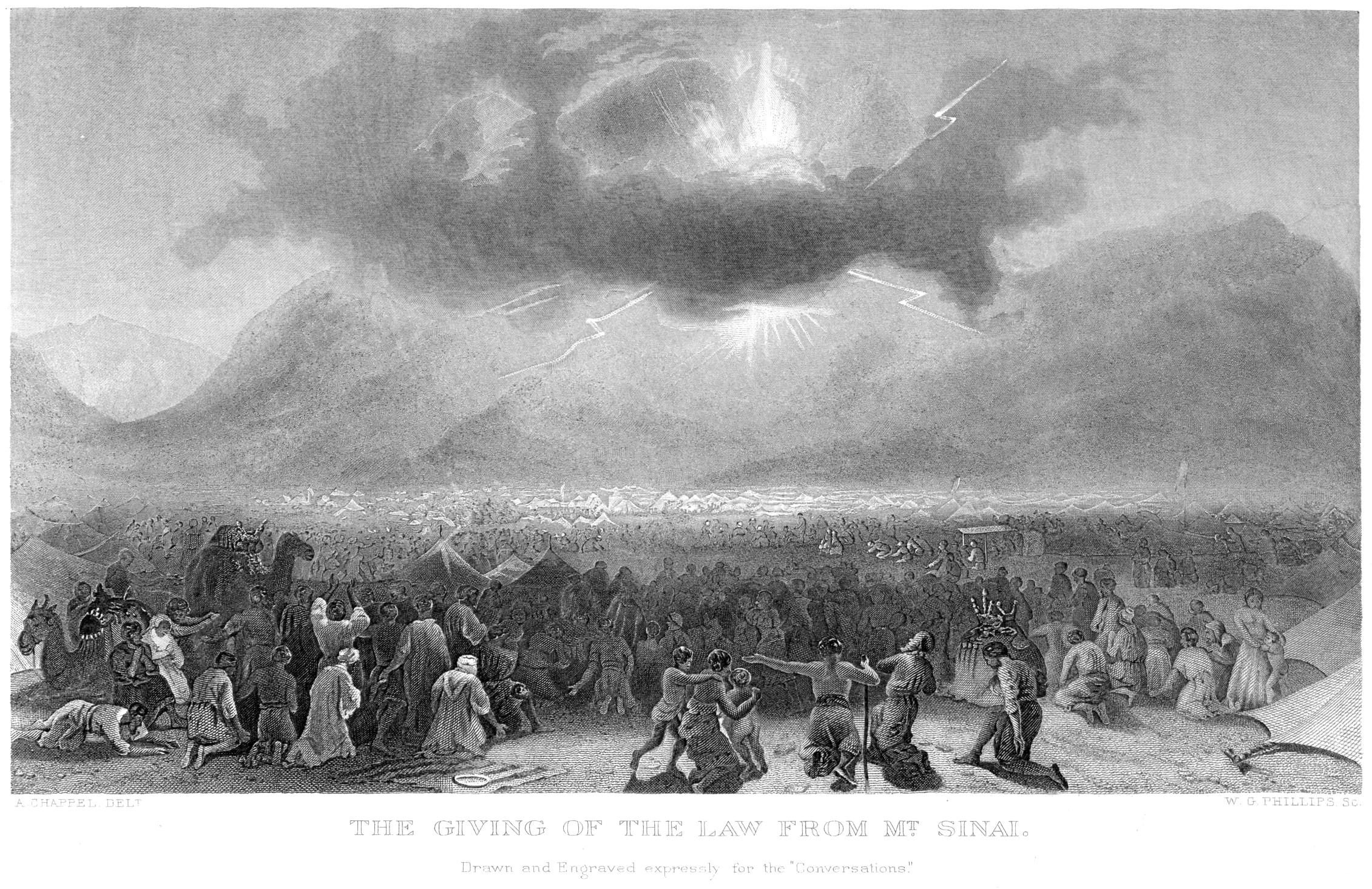
And mount Sinai was altogether on a smoke, because the LORD descended upon it in fire: and the smoke thereof ascended as the smoke of a furnace, and the whole mount quaked greatly. (Exod. 19:18)
According to the biblical record of the Exodus, the Hebrews spent eleven months and five days encamped at Mount Sinai. During the initial months of their stay, the mountain was associated with a frightening display of dense clouds, smoke, fire, thunder, lightning, earthquakes, the sound of a loud trumpet, and the voice of God. Multiple scriptures reference these phenomena, e.g., Exod. 19;16; 20:18; Deut. 4:11-12; and 5:23.
The Volcanic Theory History
These pyrotechnic-like descriptions have led some investigators to suppose that the mountain was a volcano. In so doing, traditional mountain locations within the Sinai Peninsula had to be jettisoned because it lacked geological evidence of “recent” volcanic activity. The only area in the region potentially meeting this requirement are the lava fields (ῌarrah) in northwest Arabia.
The first investigator to propose the volcanic idea was British explorer and Bible scholar Charles T. Beke, who published the pamphlet “Mount Sinai a Volcano” in 1873. Beke surmised that the mountain should be located along the route that Moses took on his return to Egypt from Midian (in northwest Arabia). Hence, he focused on the mountains at the head of the Gulf of Aqaba, in particular, Mount Baghir (Mt. Sheikh Mohammed Baghir), or Jabal an-Nur (“mountain of light”). Its 1550 m (5090’)-high peak (at 29.592° N, 35.129° E) is about 10 miles northeast of Aqaba (Figure 1), on the north shoulder of the key Wady Ithm pass.
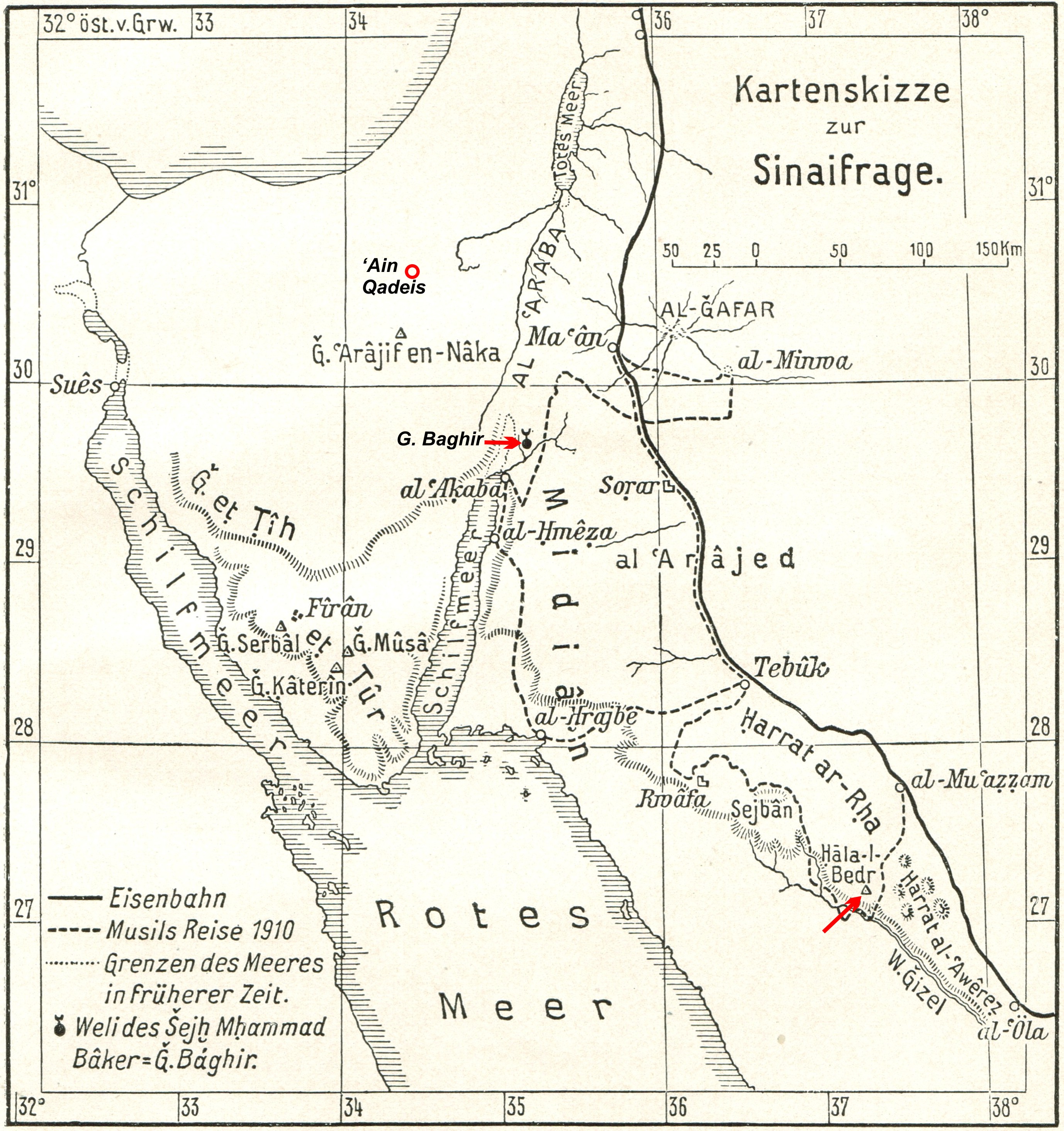
Figure 1 The locations of Hala-l-Bedr, G. Baghir, and Ain Qadeis. (Adapted from Oberhummer 1912, Plate 3.)
When Beke visited his surmised “Mount Sinai,” he found that it was not volcanic and withdrew his volcanic theory. Only slightly crestfallen, he still advocated the place as Mount Sinai:
I believed I should find a volcano where I placed Mount Sinai. I find the ‘Mountain of Light,’ but no volcano. I am therefore now bound to confess that I was in error in regards the physical character of Mount Sinai, and the appearances mentioned in Scripture were a little volcanic as they were tempestuous (1878, 436).
Fifty years later, Alfred Lucas (1938, 71) also favored this same site for Mount Sinai, although he did not expect it to be volcanic. But, his explanation of its location was rather confused because he stated that it was in Midian, However, this locale also was part of the Seir range (ibid. 78), which he placed in the territory of ancient Edom: “the identity of Seir with Edom is certain” (ibid. 74). If Mount Baghir was in Mount Seir, and it was considered part Edom, then a conflict exists because the Hebrews were not permitted to violate Edomite territory (Num. 20:17-21; Deut. 2:5).
Following Beke, other commentators persisted with the volcanic theory. German theologian Hermann Gunkel turned his attention to the volcanic areas of northwest Arabia, noting that the Sinai Peninsula lacked volcanos (1903, 3058; 1904, 160; Dorner 1905, 69). Eduard Meyer (1906, 69), followed suit, based largely on the observation of German theologian Julius Wellhausen that Mount Sinai was in Midian (1889, 349). Adding extra-biblical intrigue, Meyer fancied that Jehovah was originally a volcanic fire god indigenous to Midian (Oberhummer 1912, 674).
Wellhausen suspected a northwest Arabia location for Mount Sinai based on its association with the Madian (Midian) of the ancient classical geographers. Citing Deut. 33:2, “The Lord came from Sinai, and rose up from Seir unto them; he shined forth from mount Paran,” he observed:
The Midian of Exodus 2 tells us most: it is probably Madian on the Arabic shore of the Red sea. In our passage Sinai seems to be southeast of Edom; the way from Sinai to Kadesh is by Seir and Paran (1883, 364, n. 1; Wellhausen, et. al. 1885).
Baltimore Professor Paul Haupt (1909) similarly opined that “Mount Sinai cannot be located on the Sinaitic Peninsula; it was a volcano in the land of Midian” (Oberhummer 1912, 675). Professor Oberhummer, in his 1912 treatise, “The Sinai Problem,” proposed that Mount Sinai was likely Hala-l-Bedr, the dormant volcano described in 1910 by explorer Alois Musil (1926, 214-216). The location of Hala-l-Bedr is shown in Oberhummer’s map in Figure 1.
Despite Musil’s detailed description of Hala-l-Bedr (ibid.), he ultimately opted for a Mount Sinai location within the supposed domain of ancient Midian:
We locate Mount Horeb by the sêcĭb [sheib] of al-Hrob, in the northeastern part of the al-Hrajbe table-land” (ibid. 263).… The main camp of the Israelites…[was] twenty kilometers to the north of ‘Ajnuna (ibid. 269).
Hrob may be an Arabic form of the Hebrew Horeb. A sheib is a wide, shallow, ephemeral stream bed. The watershed of this sheib originates to the northeast in the “az-Zihed” mountain range (ibid. 117). Musil’s sheib of al-Hrob, Jabal az-Zihed, and Ajnuna are shown in Figure 2. The Jabal az-Zuhd peak (28.306° N, 35.299° E) is quite distant from Hala-l-Bedr, which lies 225 km (140 mi.) to the east-southeast.
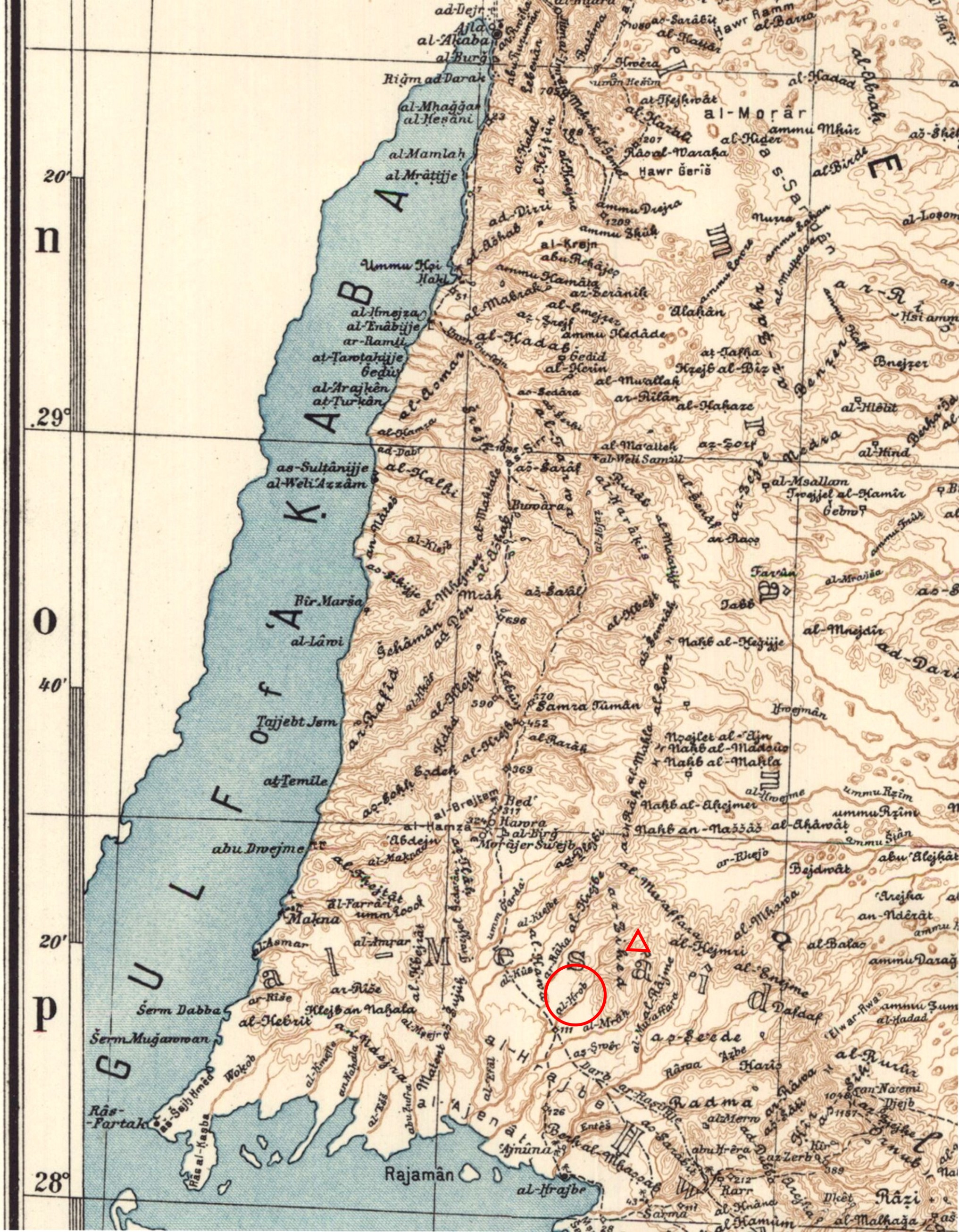
Figure 2 The Location of Musil’s “Mount Sinai” in Midian. Sheib al-Hrob is circled. The triangle designates the peak of Jabal az-Zihed. The Ajnuna (Aynunah) settlement is 20 km (12 mi.) south near the Red Sea coast (adapted from Musil 1926).
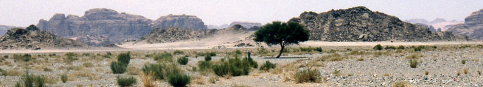
Hala-l-Bedr is an extinct cinder cone volcano perched on Jabal Thadra (“Tadra,” ibid. 214) in Al Jaww (Brown et al. 1989, A153). Figure 3 views the formation from the sout. Hala is Arabic for volcano or lava, while Badr means full moon. It is suspected to have been active in the last 10,000 years, considering Musil’s report that Bedouin and their flocks were destroyed there in historic times (1926, 214). The 1500 m (5000’) crater elevation rises 300-450 m (1000-1500’) above the surrounding terrain. It is situated at 27.253° N, 37.247° E, about 335 km (210 mi.) southeast of the head of the Gulf of Aqaba. The mountain and its foothills exhibit stone circles and other evidences of historic or prehistoric activity.
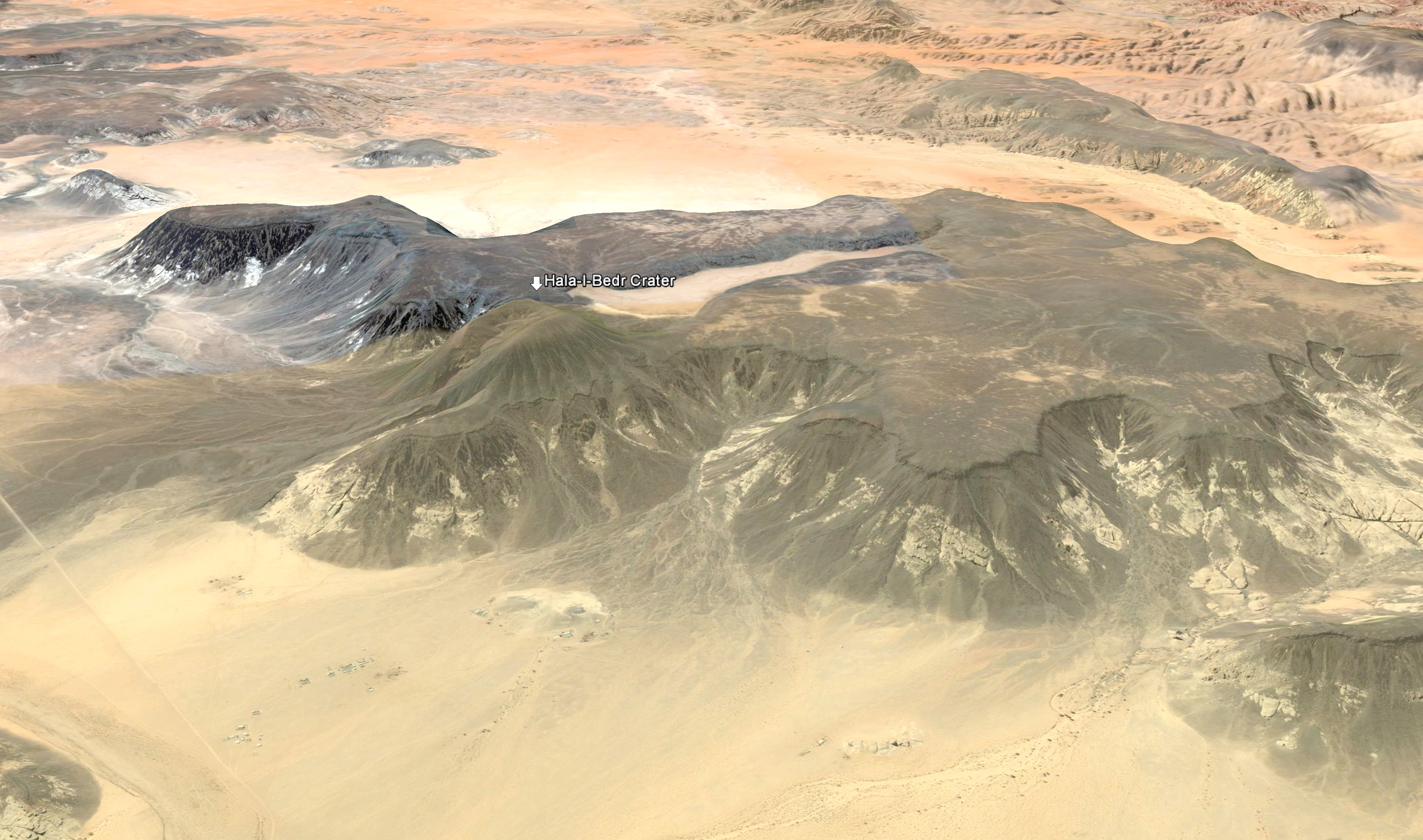
Figure 3 Hala-l-Bedr Volcano viewed from the south. The crater is located just left of center (image derived from Google Earth).
Following Oberhummer, Rev. W. J. Phythian-Adams (1930) provisionally affirmed “the identity of this mountain, Tadra-Hala el-Bedr with the Biblical Mountain of God, Horeb-Sinai” (ibid. 209). He also opined that it explained the pillar of cloud and fire that the Hebrews followed in the Exodus:
The stupendous pillar which rose from the far horizon existed not from fantasy, but in fact; nor could a more unerring guide have been chosen to lead the way to the Mount of God, since it was from the mouth of the Mount itself that this beacon of smoke and flame lifted its towering head (ibid. 138-139).
Phythian-Adams noted that Old Testament scholar Hugo Gressmann (1913, 192) had, years earlier, given this same explanation for the pillar. Nonetheless, this notion presents some difficulties.
The biblical mentions of the pillar infer both proximity and motion, not a static phenomenon emanating hundreds of miles in the distance. For instance, when the Hebrews left Egypt,
The LORD went before them by day in a pillar of a cloud, to lead them the way; and by night in a pillar of fire, to give them light; to go by day and night: He took not away the pillar of the cloud by day, nor the pillar of fire by night, from before the people (Exod. 13:21-22).
As a practical matter, a volcanic eruption in the Arabian Peninsula would not likely illuminate the night path for travelers 350-550 km (220-350 mi.) distant in the Sinai Peninsula. If its eruption was of that great magnitude, no multitude would have been able to assemble at its base, and Moses would not be able to ascend its peak.
Furthermore, when the Hebrews were encamped at the sea, the pillar was locally manifest and moved between them and the Egyptians (Exod. 14:19). At later times, the cloud stood above the tabernacle, entirely separate from the mountain (Exod. 43:9; 40:34; Num. 12:5). As the Hebrews traveled beyond Mount Sinai, “the cloud of the LORD was upon the tabernacle by day, and fire was on it by night, in the sight of all the house of Israel, throughout all their journeys” (Exod. 40:38). This phenomenon was still occurring near the close of the Exodus (Deut. 31:15). A careful reading of the pertinent scriptures argues against a volcanic basis for a moving pillar of light and cloud.
The Volcanic Theory in the 21st Century
In recent decades, Jean Koenig (1971), and then Colin Humphreys (2003), also advocated Hala-l-Bedr as the site for Mount Sinai. Humphreys went into great detail to explain his idea, summarizing that
The Old Testament description of Mount Sinai fits perfectly an eyewitness description of an erupting volcano, even down to the details like the loud trumpet sound produced by gases escaping through cracks in the rocks (ibid. 310-312).
His location for Mount Sinai was based on two basic criteria: 1) a volcano that was active in the last 10,000 years, 2) located within 11 days’ travel from Kadesh. The evidence for the historical eruption activity of Hala-l-Bedr chiefly stems from the report of Musil (1926), cited above. Although Humphreys found three volcanos that met his distance criterion, he chose Hala-l-Bedr because it had the highest explosive index, which gave it a potential three-mile-high eruption column.
The 11-day parameter is derived from Moses’ statement in Deut. 1:2 that “there are eleven days’ journey from Horeb by the way of mount Seir unto Kadeshbarnea.” Kadeshbarnea or Kadesh, on the southern bound of the land of Canaan (Num. 12:16; 13:26), was the key destination after leaving Mount Sinai. For his calculations, Humphreys chose the traditional site for Kadesh at Ain Qadeis, in the eastern Sinai Peninsula, 135 km (85 mi.) northwest of the head of the gulf (Figure 1). Without going into detail, Ain Qadeis, the default site by tradition, does not fully comport with the biblical geography of Kadesh.
According to Humphreys, the Mount Sinai volcano had to be within 412 air miles (663 km) of Ain Qadeis in order to be within 11 days’ travel. This idea was based on historical Hajj caravan rates of 60 km (37.5 mi.) per day using camels. But, this assumption has three problems: 1) air miles don’t equate to overland miles, 2) the 37.5 mi. per day travel rate is very ambitious, and 3) Exodus-era caravan rates were not necessarily comparable with the more recent Hajj rates.
Other Hajj rate estimates are much lower, in the range of 25-26 miles per day (Al-Wohaibi 1973; Lipschitz 1978), or 2-1/4 to 2-1/2 miles per hour (Ritter 1866). Furthermore, Hajj travel was facilitated by roadbed improvements and a rigid itinerary relying on prepositioned water and supply stations. The Exodus-era caravan travel referenced by Deut. 1:2 did not have this same degree of advantage.
Humphreys calculated the Hebrews’ ground distance between Hala-l-Bedr and Ain Qadeis at 352 mi. (567 km), which he divided into 11 “stages,” each averaging a very brisk 32 mi. (52 km) per day. For the sake of comparison, the Hebrews may have averaged 20.5 miles (33 km) per day in their hurried transit between Egypt and a Yam Suph located at the Gulf of Aqaba (Fritz 2016).
Ironically, Humphreys’ route between his “Mount Sinai” and Kadesh did not retrace the path that he had mapped for the Hebrews’ journey to Hala-l-Bedr (2003, 329). Instead of routing them back through Aqaba, he sent them along the east side of Mount Seir, as far as Petra, where they turned west to traverse the mountains of Edom. The problem with this idea (mentioned previously) is that the Edomites prohibited any Hebrew passage through their territory (Num. 20:14-21; Judg. 11:17).
Another glitch is that there were 14 encampments in the journey between Mount Sinai and Kadesh (Num. 33:16-30), not the 11 “stages” that Humphreys proposed. The key to deciphering this itinerary is to recognize that Kadesh was not named. Instead, Moseroth was used as a proxy for Kadesh in Num. 33:30-31. In explanation, the verb root of Moserah (pl. Moseroth) means “chastise” (Strong 1990, H3256, H4147), referring to the punishment of the Hebrews for their ignoble behavior at Kadesh. Following this pattern, Moserah was given as the place of Aaron’s death in the 40th year of the Exodus (Deut. 10:6). Aaron actually died on Mount Hor (Num. 20:28), which was adjacent to Kadesh, based on the sequence of events in Num. 20:14, 22, 23, 28; 21:1, 4.
Although Humphreys provided a grand exhibition of his Hala-l-Bedr theory for Mount Sinai, the details involve numerous geographical difficulties.
Summary of the Volcanic Idea
There is a 130-year history of volcanic theories for Mount Sinai. The main problem is that the idea must add significant distance to the two-month journey between Egypt and the wilderness of Sinai (cf. Exod. 12:2, 6, 51 with 19:1). In addition, Hala-l-Bedr is distant from the classical domain of Midian, which was located east of the Gulf of Aqaba and northeast of the head of the Red Sea. The heart of this region appears on Musil’s map in Figure 2. The southern fringe of this territory is about 130 air miles (210 km) from Hala-l-Bedr, with a ground distance that equates to about a one-week journey on foot.
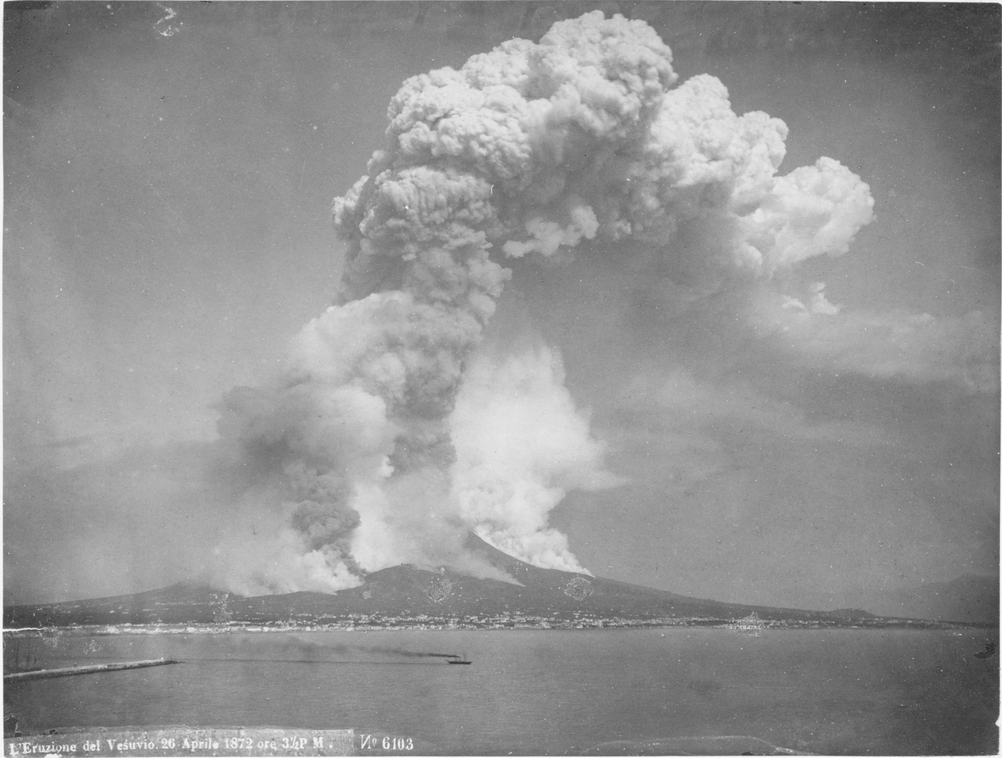
Figure 4 The Eruption of Vesuvius 1872 (Library of Congress)
The Mount Sinai Activities
The volcanic theories reviewed above all seem to ignore the potentially noxious environments associated with active volcanoes. The “elephant in the room,” the obvious element missing from the arguments, concerns the incompatibility between human activity and volcanic eruptions. To provide a visual, an 1872 eruption of Mount Vesuvius is shown in Figure 4.
As mentioned above, Humphreys (2003) selected Hala-l-Bedr because it had the potential for a three-mile-high eruption column. The products of this sort of eruption would include ejecta or tephra, steam, gasses, and molten lava flows. Tephra denotes pyroclastic materials of all sizes: ash, blocks, and semi-solid or molten bombs. Ash refers to particles less than 2 mm in diameter, composed of various minerals, pulverized rock, and volcanic glass. Gasses include water vapor, carbon dioxide, carbon monoxide, sulfur dioxide, hydrogen, and hydrogen sulfide.
The tephra fallout from volcanic plumes is very hazardous, easily deadly to man, animals, and vegetation. Surface accumulation of ash prior to the arrival of the Hebrews would inhibit, if not preclude, pastoral and habitation activity. In the least, ash is a significant respiratory and eye irritant. It has been observed that sheep that survive volcanic ash falls may become immobilized by its weight in their wool.
A review of the biblical human interaction with Mount Sinai is needed to highlight the potential problem. Of note is the protracted human activity within the mountain and the fact that Moses spent more than 80 days in its heights.
Upon the arrival at Mount Sinai, the Lord called to Moses out of the mountain (Exod. 19:3) saying, “I have come in a thick cloud that the people may hear when I speak with you…” (19:9). The inference is that the cloud shielded the people from the deadly energy field (“glory”) of the Lord, allowing him to be close enough to be heard.
The people were told to prepare for the third day, when the Lord would come down upon the mountain (19:11), and a trumpet would signal them to come to the base of the mountain (19:13). On the third day, there were thunders, lightnings, clouds on the mountain, and the voice of a trumpet (19:16). “Mount Sinai was wrapped in smoke, because the LORD descended upon it in fire; and the smoke of it went up like [simile] the smoke of a kiln, and the whole mountain quaked greatly” (19:18 RSV).
The Lord called Moses to the top of the mountain (19:20). He was told to go down to warn the people to stay back, under penalty of death, and to bring Aaron back up with him (19:21, 24). It is important to note that death would be administered at the hand of man, by stoning or spearing (Exod. 19:13), not by injurious properties of the mountain.
“And all the people saw the thunderings, and the lightnings, and the noise of the trumpet, and the mountain smoking: and when the people saw it, they removed, and stood afar off” (20:18). “…and Moses drew near unto the thick darkness where God was” (20:21). “And he said unto Moses, come up unto the LORD, thou, and Aaron, Nadab, and Abihu, and seventy of the elders of Israel; and worship ye afar off” (24:1). “Then went up Moses, and Aaron, Nadab, and Abihu, and seventy of the elders of Israel” (24:9). These men saw the God of Israel with a pavement of sapphire under his feet; and they ate and drank (24:10-11).
Moses was told to go up further in the mount to receive the tables of stone. He took Joshua with him, while the elders tarried. The cloud continued to cover the mountain (24:12-15), with the “glory of the Lord” abiding on Mount Sinai for six days. On the seventh day, Moses was called up (24:16). The glory of the Lord was like [simile] a devouring fire (24:18). Moses then spent forty days and nights in the mountain (24:18). At the end of this period, Moses (and Joshua) returned to find the people corrupted, worshipping the golden calf, and Moses broke the stone tablets (32:15-17).
Moses asked of the Lord to see his glory and was instructed to stand on a rock in the mountain near the Lord’s presence. When the Lord passed by, he put Moses in the cleft of a rock to protect him (33:18-23). Moses was instructed to go down and hew tables of stone like the first, and then return to the top of the mountain (34:1-4). Upon When Moses’ return to the heights, the Lord descended in a cloud and passed before him (34:5-6). “And he was there with the LORD forty days and forty nights; he did neither eat bread, nor drink water. And he wrote upon the tables the words of the covenant, the ten commandments” (34:28).
In this series of events, Moses made about five trips up the mountain. On one excursion, he was accompanied by over seventy people, who experienced benign conditions under which they could tarry, and eat and drink. Moses spent two, forty-day periods in the heights. All of these men moved freely up and down the mountain without mention of being hampered by supposed pyrotechnic phenomena: heat, fumes, ash, or lava flows. In all, the Hebrew multitude and their vast herds spent eleven months and five days around Mount Sinai.
Over the last century, volcanologists have well-documented the attendant geophysical dangers of erupting volcanos. The theories proposing that Mount Sinai was a volcano seem to fantasize about the prospect without adequately addressing the unpredictable and dangerous aspects of volcanic activity.
Theophany at Mount Sinai
The ongoing phenomena observed at Mount Sinai are best described as a theophany: a visible manifestation of God to humankind. In fact, the Lord explained his manifestation: “I come unto thee in a thick cloud, that the people may hear when I speak with thee…” (Exod. 19:9). In Exod. 24:16 and 17, “the glory of the Lord” (Hebrew: h’kavod YHWH) abode on the top of Mount Sinai as a “cloud” and “like devouring fire.” “The glory of the Lord” phrase, which occurs 33 times in the KJV, usually signals a theophany. It is most frequently associated with a “cloud,” and less frequently with “fire.” The phrase was first used when the Hebrews entered the Wilderness of Sin, 30 days beyond Egypt and “the glory of the LORD appeared in the cloud” (Exod. 16:7 and 10).
Despite their benign intent, the divine displays at Mount Sinai were frightful to the Hebrews, who pled with Moses, “Speak thou with us, and we will hear; but let not God speak with us, lest we die” (Exod. 20:19). The Psalmist gave this retrospective:
O God, when thou wentest forth before thy people, when thou didst march through the wilderness; Selah: The earth shook, the heavens also dropped at the presence of God: [even] Sinai itself [was moved] at the presence of God, the God of Israel” (Psalm 68:7-8 KJV).
References
Beke, Charles Tilstone. 1873. Mount Sinai a Volcano. Tinsley Brothers.
Beke, Charles T. Beke, Emily Beke, ed. 1878. The Late Charles Beke’s Discoveries of Sinai in Arabia and of Midian. London: Trübner & Co.
Brown, G. F., D. L. Schmidt, A. C. Huffman, and A. Curtis, Jr. 1989. Geology of the Arabian Peninsula; Shield Area of Western Saudi Arabia. U. S. Geological Survey Professional Paper no. 560-A. Reston, Virginia: U. S. Geological Survey.
Dorner, Albert. 1905. Beiträge zur Weierentwicklung der christlichen Religion. München.
Fritz, Glen A. 2016. The Lost Sea of the Exodus: A Modern Geographical Analysis, 2nd Ed.. San Antonio: GeoTech.
Gunkel, Hermann. 1904. Ausgewählte Psalmen. Göttingen: Vandenhoeck und Ruprecht.
Gunkel, Hermann. 1903. Deutsch Literatur-Zeitung.
Gressmann, Hugo. 1913. Mose und seine Zeit : ein Kommentar zu den Mose-Sagen. Göttingen: Vandenhoeck & Ruprecht.
Haupt, Paul. 1909. The Burning Bush and the Origin of Judaism. Philadelphia.
Humphreys, Colin. 2003. The Miracles of Exodus: a scientist’s discovery of the extraordinary natural causes of the Biblical stories. New York: Continuum.
Jean Koenig. 1971. Le site de al-Jaw dans l’ancien pays de Madian. Paris: Paul Geuthner.
Lipschitz, Ora. 1978. Sinai, Part I. Tel Aviv: Simor Ltd.
Lucas, Alfred. 1938. The Route of the Exodus of the Israelites from Egypt. London: Edward Arnold & Co
Meyer, Eduard, and Bernhard Luther. 1906. Die Israeliten und ihre Nachbarstämme. Halle: Max Niemeyer.
Musil, Alois. 1926. The Northern Hijaz: A Topical Itinerary. American Geographical Society Oriental Explorations and Studies No. 1, J.K. Wright, ed. New York.
Phythian-Adams, W. J. 1930. The Mount of God. Palestine Exploration Fund Quarterly Statement (July): 135-149, 192-209.
Ritter, Carl. 1866. The Comparative Geography of Palestine and the Sinaitic Peninsula, trans. William L. Gage. New York: D. Appleton and Co.
Strong, James. 1990. Strong’s Exhaustive Concordance. Nashville: Thomas Nelson.
Wohaibi, Abdulla Al-. 1973. The Northern Hejaz in the Writings of the Arab Geographers 800-1150. Lebanon: Al-Risalah.
Wellhausen, Julius. 1883. Prolegomena zur Geschichte Israels. Berlin: Reimer.
Wellhausen, Julius, J. Sutherland Black, and Allan Menzies. 1885. Prolegomena to the History of Israel. Edinburgh: A&C Black.
Wellhausen, Julius. 1889. Prolegomena zur Geschichte Israels 5th ed. Berlin: Reimer.