Water provision at Mount Sinai? The biblical Exodus from Egypt began after Passover, observed on the 14th day of Aviv, the first month on the Hebrew lunar calendar. Aviv would correspond with March/April on our calendar. Two months later, the Hebrews arrived in the wilderness of Sinai (Exo. 19:1). They subsequently encamped in the vicinity of Mount Sinai for eleven months and five days.

Based on Moses’ censuses, the multitude numbered at least 1.5 million. They also had “flocks, and herds, even very much cattle” (Exo. 12:38). Due to the arid conditions that dominate the Exodus region, questions naturally arise about the supply of water during the lengthy stay at the mountain.
We do know from paleoclimate studies of the Dead Sea that the time frame of the Exodus experienced increased rainfall. The Bible also provides a hint that heavy rain may have fallen at Mount Sinai and elsewhere during the Exodus:
“When you, God, went out before your people, when you marched through the wilderness, the earth shook, the heavens poured down rain, before God, the One of Sinai, before God, the God of Israel. You gave abundant showers, O God; you refreshed your weary inheritance” (Psa. 68:7-9 NIV).
We also know that a brook on Mount Sinai supplied water:
“Then I took…the calf which you had made, and burned it with fire and crushed it and ground it very small, until it was as fine as dust; and I threw its dust into the brook that descended from the mountain” (Deu. 9:21).
This water appears to have pooled at the base of the mountain:
“Then he took the calf which they had made, burned it in the fire, and ground it to powder; and he scattered it on the water and made the children of Israel drink it” (Exo. 32:20).
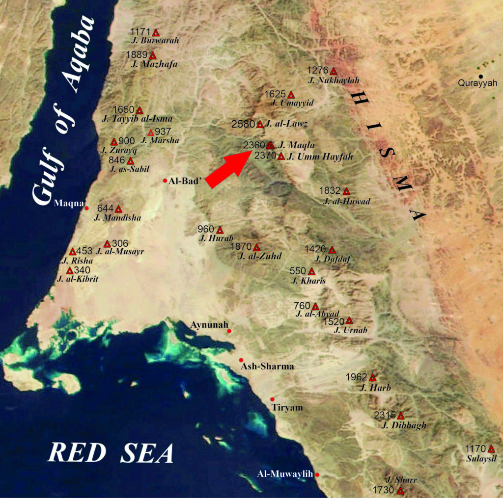
Can these observations be applied to the more recent Exodus geographical data? The book, The Exodus Mysteries: of Midian, Sinai & Jabal al-Lawz, made the geographical case for a Mount Sinai location at Jabal al-Maqla in the Jabal al-Lawz mountain range of northwest Arabia. The Figure 1 map shows this location.

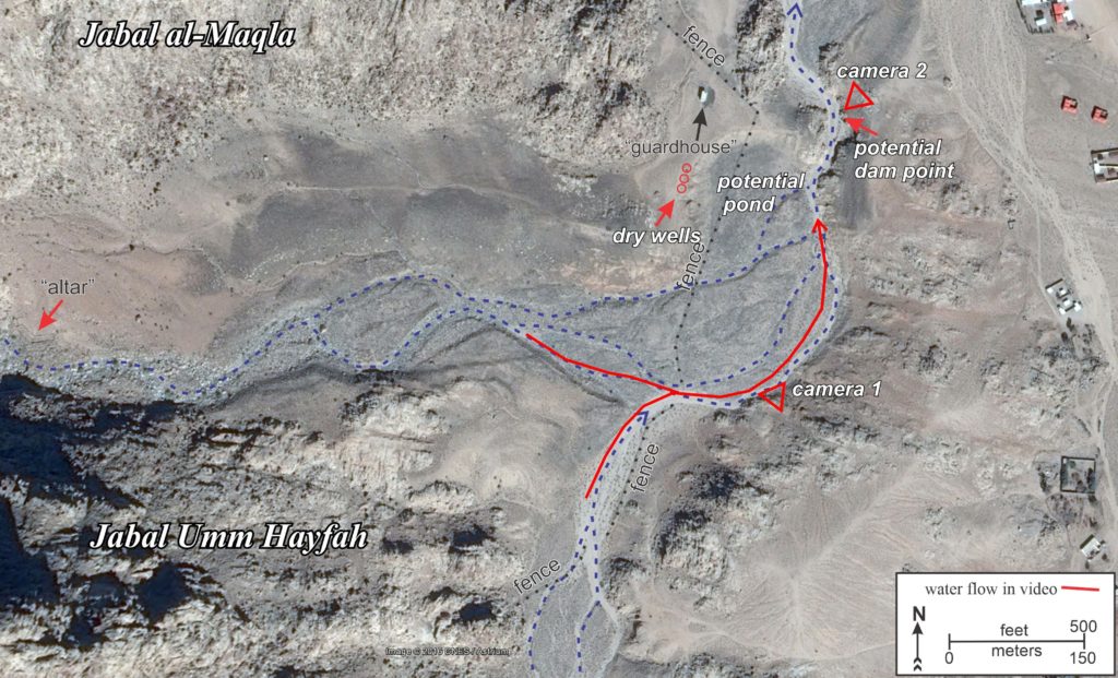
The eastern face of Jabal al-Maqla does host an ephemeral stream bed. At the base of the mountain, it meets the drainage from the adjacent Jabal Umm Hayfah (on the south). The combined flow proceeds northward, eventually emptying into the Wadi al-Abyad. This arrangement is mapped in Figure 2.

It is hypothesized that at the time of the Exodus, water draining from these mountains could have formed a large pond at the base of the mountain, provided that a small dam was built at the narrow northern outflow. On the west bank of this area, several “dry wells” have been discovered that may have been used to harvest water via seepage. The position of these wells is marked in Figure 2. These structures are explained in greater detail in The Exodus Mysteries.
In modern times, significant precipitation events at Jabal al-Maqla seem few and far between. However, in mid-January of this year, significant snowfall occurred in the Jabal al-Lawz region, shown in this video clip*: SNOW.
In addition, heavy rain fell in mid-March. The heavy runoff at the base of Jabal al-Maqla is shown in this video clip*: RAINSTORM. The camera positions and the stream flows are marked in red in Figure 2.
If precipitation events such as these occurred here during the Exodus, it is easy to see how water management and harvesting practices could have provided for the herds and people. Stream discharges would also have benefitted areas well-removed from the base of Jabal al-Maqla that were occupied by the Hebrews.
*Video clips adapted from footage taken by @Turki__2020. A “Hat Tip” to Andrew Jones for technical assistance
